
Booking a private yacht charter is an easy task when you get familiar with the area and route to be taken, and for those first time visitors this is made easier here with the Puerto Plata catamaran tour map that shows the points of interest and useful information on the coastal attractions of the North Coast.
For those who charter their own yacht, or customize a private charter, we published the Puerto Plata yachting article that covers all the marinas, piers, harbors and nautical attractions of the entire North Coast. Here we cover the snorkel and diving points that most 4-hour catamaran charters cover.
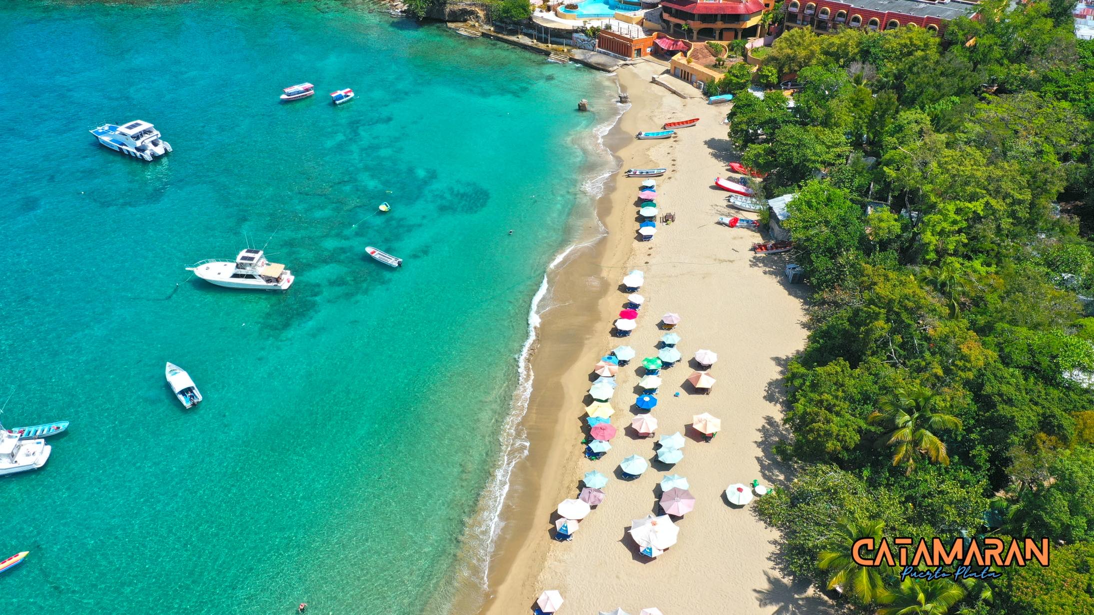
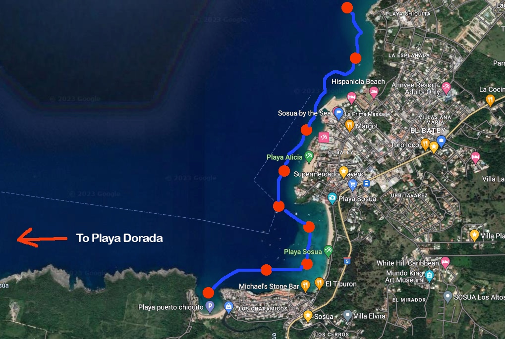
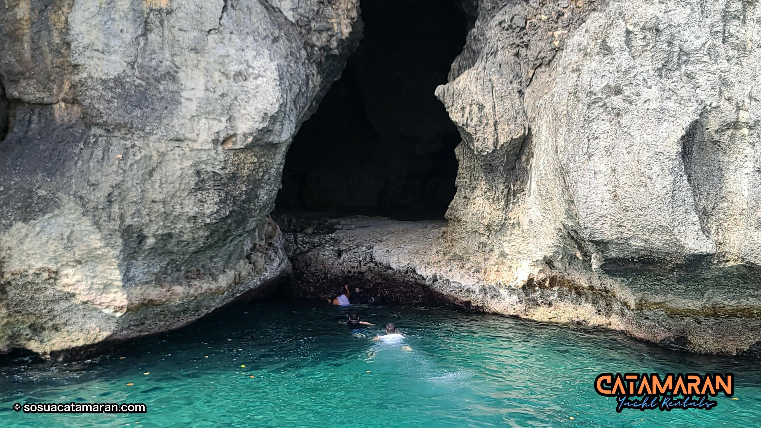
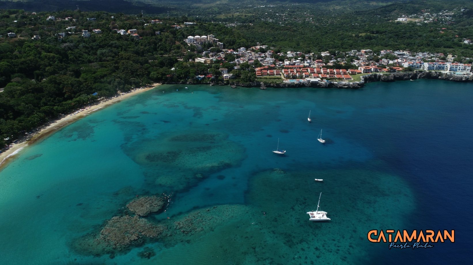
The Sosua Bay route departs from the beach in Sosua, a small coastal town with a unique scenic landscape. The charter route can start right on the bay where several snorkel and dive points are found including Los Cabezos and Atabey, a Taino statue so large it can be seen from above the water.
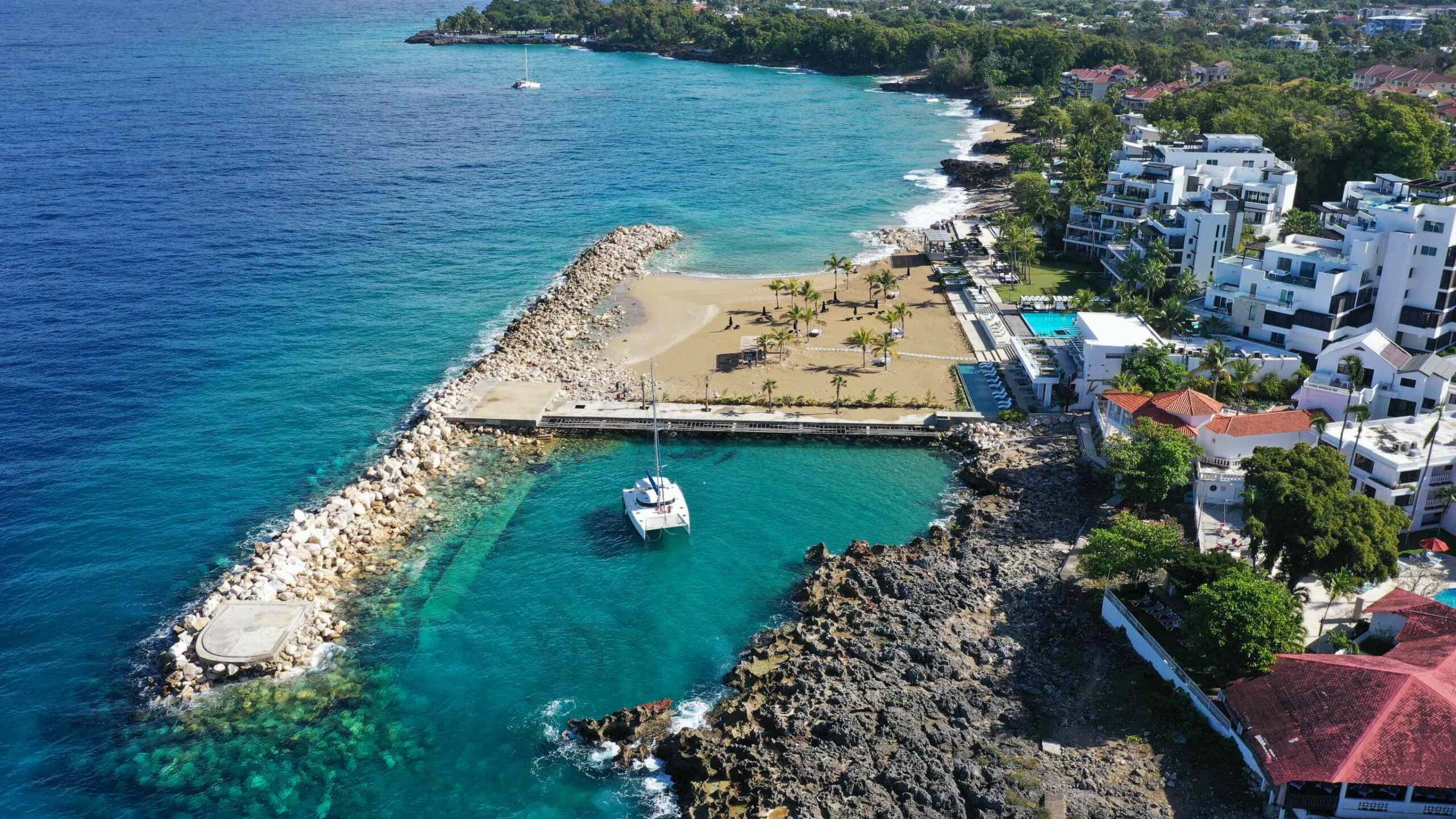
Next in line going West we find Puerto Chiquito Beach (also called Tablon), a secluded beach where Sosua fishermen have a small village by the river mouth.
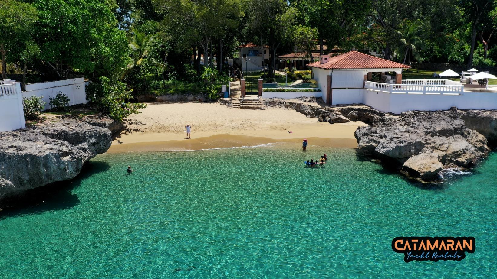
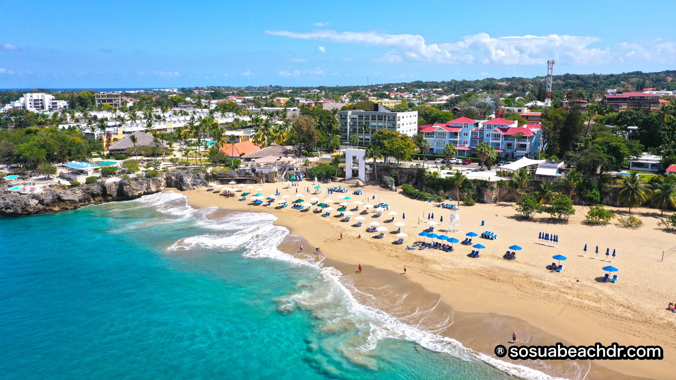
Going East the catamaran sails by a landmark tiny beach just below clifftop Piergiorgio hotel, a new beach formed in late 2020. Right next there is Alicia Beach, another beach formed not that long ago, in 2017. Today it is one of the nicest beach in the North Coast.
Going further East we find Casa Marina beach, where the resort with the same name is located, and next to it Imbert Beach with the Ocean Club and the Three Rocks snorkel site. This site consists of three reef pinnacles just 300 meters off the coast, teeming with tropical fish and a must visit for every catamaran tour in the Puerto Plata region.
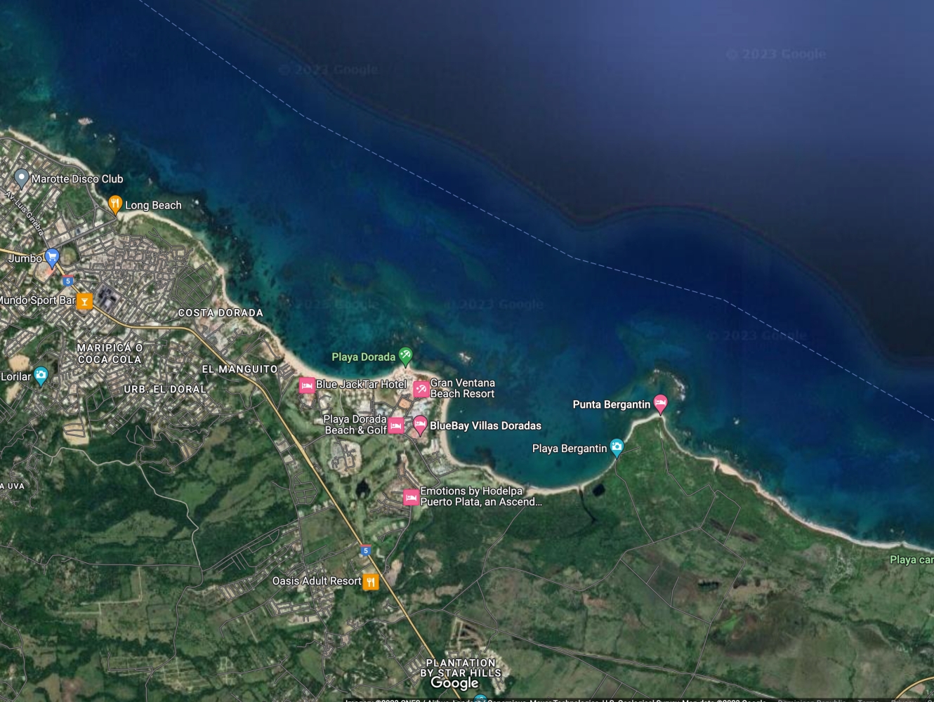
The Playa Dorada, Puerto Plata catamaran tour map shows the reefs (darker spots) along the coast, all the way from Long Beach to Costa Dorada, Playa Dorada, and Bergantin. These reefs have life, but not as much as rich as the Sosua route. This is why most catamarans end up going to Cabezos or Three Rocks.
The pros of these areas are the close proximity to the beach resorts, from where some collective catamaran tours depart from and sail along the coast towards the other key points.
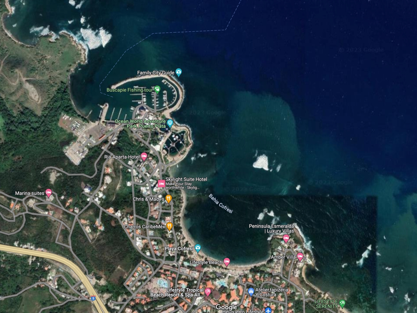
The Ocean World marina is the main hub of the North Coast, from where some private charters also depart from. These custom Puerto Plata catamaran charters are usually more expensive due to the distance, and take almost a full day to go back and forth to the North Beaches East of Cofresi.
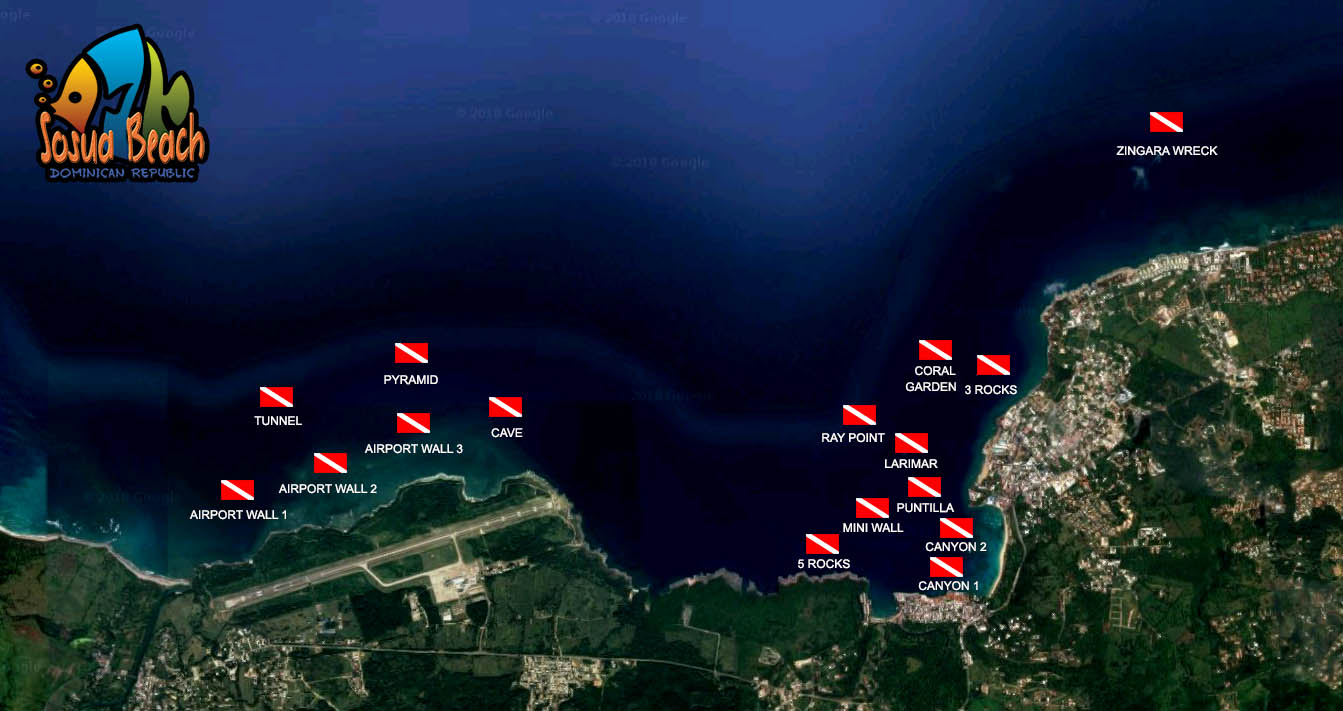
The dive and snorkel map of Sosua Bay and the Puerto Plata POP airport shows all the major points, good for those who also are interested in diving. When requested a Puerto Plata catamaran tour map, we usually include this map because some charter customers also want to try some diving before or after the cruise trip.
For captains, the lat/long coordinates of the main snorkel area is (19.773244, -70.515033) with GPS 19° 46′ 23.6784” N70° 30′ 54.1188” W; sailing East from Cofresi or Luperon Marina.